Le détroit d’Ormuz : une importance millénaire, bien antérieure au pétrole
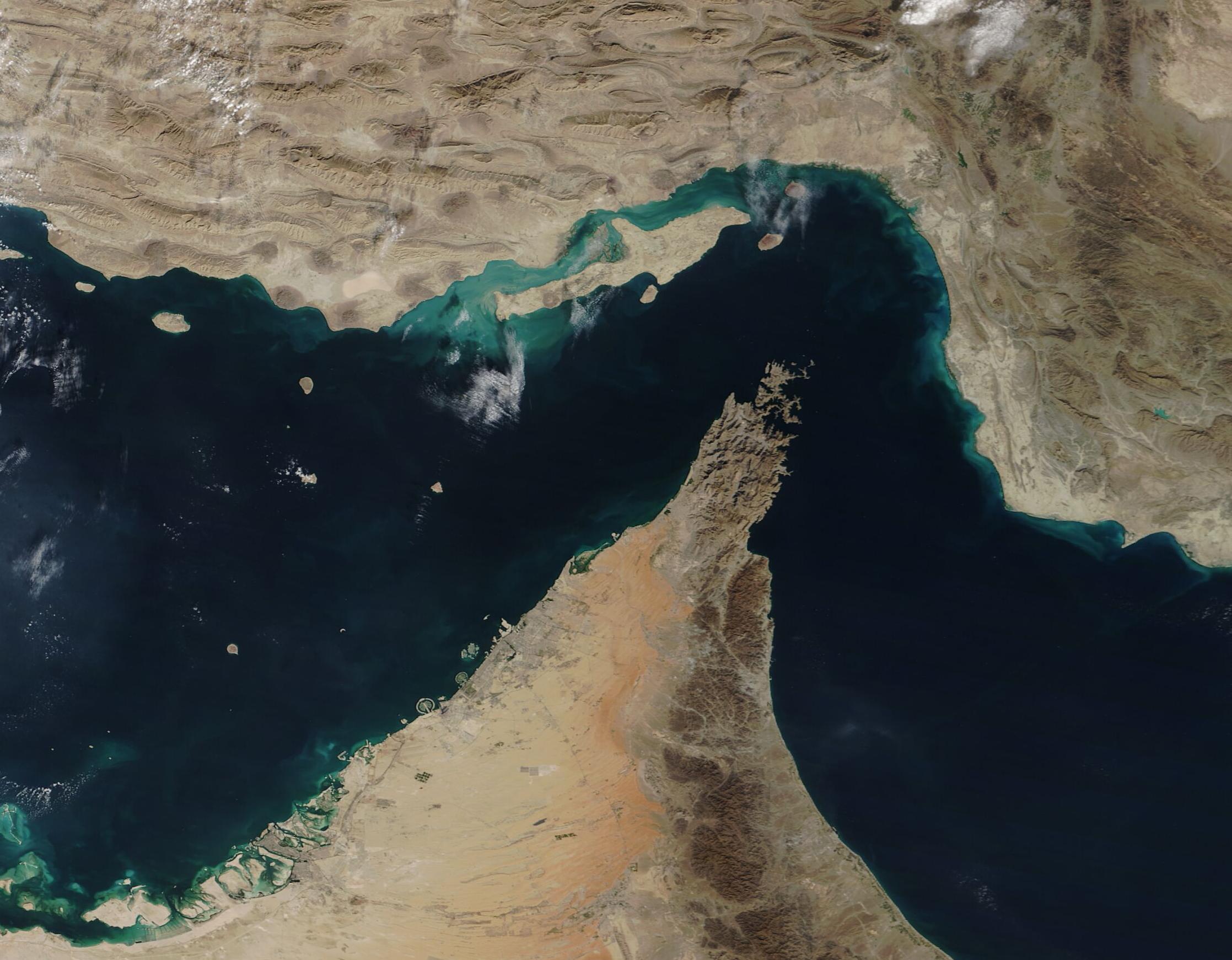
Le détroit d’Ormuz et le golfe Persique — image satellite NASA / MODIS (domaine public).
Iranica · Géopolitique · Civilisation
Le détroit d’Ormuz : une importance millénaire, bien antérieure au pétrole
Sept mille ans d’histoire dans un passage de quelques dizaines de kilomètres.
Si vous pensez que l’importance du détroit d’Ormuz et de la route maritime du sud de l’Iran repose uniquement sur le pétrole et les ressources énergétiques, alors une question se pose : pourquoi, bien avant l’Empire achéménide, les grandes puissances de l’Antiquité se sont-elles disputé le contrôle de cette région, comme l’attestent les preuves archéologiques ?
Si l’importance du détroit d’Ormuz dépendait uniquement du pétrole, pourquoi Alexandre le Grand envoya-t-il sa flotte depuis l’Inde vers le détroit d’Ormuz et les rivages du golfe Persique ? Pourquoi les souverains sassanides et leurs voisins de la rive sud du golfe se disputaient-ils cette région ? Ces conflits portaient-ils sur quelque chose d’insignifiant ?
Les origines géologiques · I
L’histoire du détroit d’Ormuz remonte à une époque très ancienne. Il y a environ dix à douze mille ans, à la fin de la dernière période glaciaire, l’endroit que nous appelons aujourd’hui le détroit d’Ormuz n’était pas une étendue maritime. Il s’agissait d’une vaste plaine recouverte d’une croûte saline, ponctuée de sources d’eau douce et fréquentée par les premières communautés humaines.
Selon les travaux du Dr Jeffrey Rose dans son étude « Persian Gulf Oasis », la fin de l’ère glaciaire, accompagnée de fortes précipitations et de la fonte des calottes glaciaires, provoqua une élévation du niveau des mers. La masse d’eau que nous appelons aujourd’hui le golfe Persique se forma progressivement.
Il y a environ sept mille ans, alors que les premières communautés s’établissaient entre le Tigre et l’Euphrate ainsi que dans le sud du plateau iranien, cette étendue d’eau commença à s’écouler vers l’océan par ce passage stratégique. Dès lors, cette voie acquit une importance considérable.
Les civilisations sumériennes et les premières routes maritimes · II
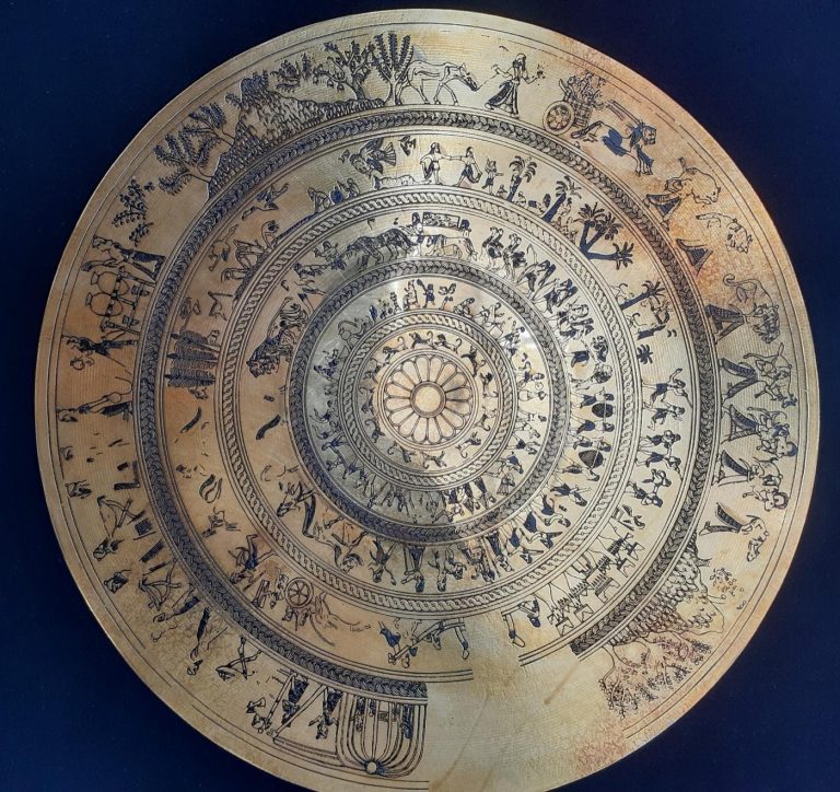
Les textes sumériens et akkadiens mentionnent à plusieurs reprises les terres situées autour du golfe Persique. Ils décrivent un monde connecté aux civilisations du Tigre et de l’Euphrate par voie maritime. Ces textes évoquent des navires, des marchandises et des routes commerciales.
Les découvertes archéologiques ainsi que la traduction des tablettes cunéiformes montrent que les commerçants de la civilisation de la vallée de l’Indus, de l’Élam et d’autres centres de civilisation situés dans l’est du plateau iranien utilisaient la mer d’Oman, la côte du Makran, le golfe Persique et le détroit d’Ormuz pour acheminer leurs marchandises jusqu’aux cités sumériennes.
Un aspect particulièrement fascinant des textes sumériens vieux de cinq mille ans est qu’ils décrivent une terre lointaine comme la « Cité des Dieux », demeure de divinités bienveillantes. Pour atteindre cette terre mythique, il fallait traverser le golfe Persique et le détroit d’Ormuz. Les preuves indiquent que l’usage de ces routes maritimes remonte à au moins six mille ans — et tout navire devait nécessairement longer les côtes du golfe.
L’époque élamite : la première puissance du golfe · III
Bien avant l’émergence des empires mèdes et achéménides, le sud de l’Iran et les rives du golfe Persique appartenaient à une grande civilisation iranienne qui n’occupe pas toujours la place qu’elle mérite dans les récits historiques : la civilisation élamite. Son centre se trouvait dans l’actuel Khouzistan, et les Élamites dominèrent une grande partie du sud de l’Iran pendant plusieurs millénaires. Car l’Iran tel que nous le connaissons est né de la fusion de deux racines : les Élamites, peuple autochtone du sud-ouest, et les Aryens venus du plateau — l’un et l’autre coulent dans les veines de la nation iranienne.
Nous ignorons le nom qu’ils donnaient au golfe Persique ou au détroit d’Ormuz, mais les études archéologiques démontrent clairement leurs liens étroits avec le monde maritime du golfe. Il ne s’agissait pas d’une simple bande côtière isolée, mais d’une région intégrée à un vaste réseau économique et culturel.
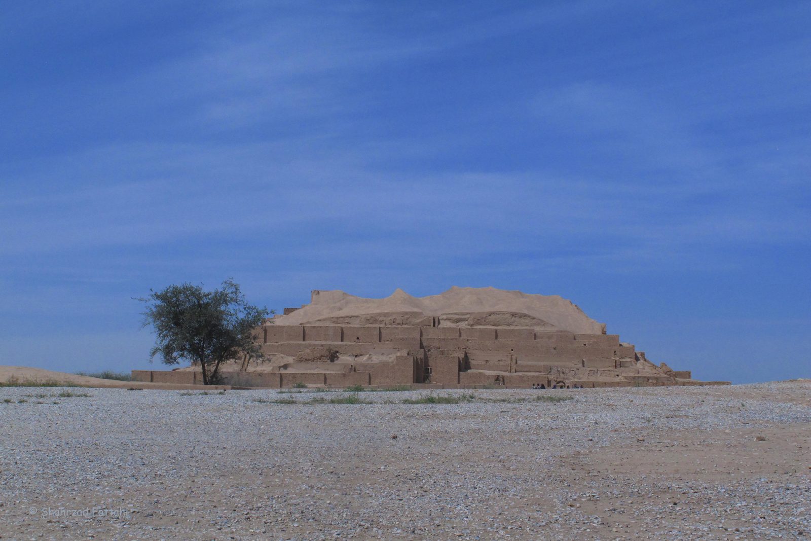
Les textes élamites témoignent d’une véritable familiarité avec le monde de l’eau. Lors de la campagne de Kidin-Hutran contre Babylone, les chroniques évoquent — parallèlement aux offensives terrestres — l’usage des voies fluviales reliant le Karoun au Tigre et à l’Euphrate : la rivière et la mer faisaient partie de leur monde. La découverte de sanctuaires et de temples élamites sur les côtes du golfe — notamment à Liyan, l’actuelle Bouchehr — confirme l’importance stratégique de ce corridor maritime. Sous l’autorité des rois élamites, le territoire s’étendait des rives du golfe jusqu’aux régions proches de l’actuel Makran ; le détroit d’Ormuz faisait naturellement partie de cette sphère d’influence. Cette région était déjà un centre de civilisation dynamique bien avant même de porter le nom d’Ormuz.
Les Achéménides et l’intégration à un système-monde · IV
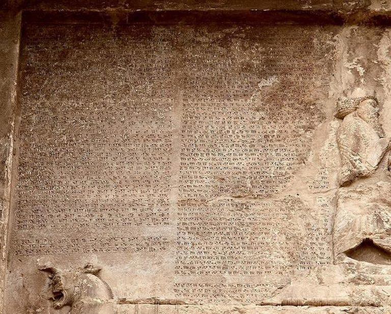
L’importance du détroit d’Ormuz devient encore plus évidente à l’époque achéménide. Sous le règne de Darius le Grand, les routes maritimes furent considérablement développées. Darius entreprit notamment la création d’une voie navigable reliant l’Égypte à l’Empire perse, préfigurant l’actuel canal de Suez.
Pour la première fois, les routes maritimes du golfe Persique furent intégrées à un système impérial de dimension mondiale. Dans les inscriptions de Darius relatives à cette voie navigable, le golfe Persique est mentionné comme une région appartenant à l’espace perse. Darius ne parlait pas simplement d’une étendue d’eau, mais d’un territoire stratégique intégré à son empire. Depuis cette époque — il y a environ deux mille cinq cents ans — le golfe Persique et le détroit d’Ormuz sont entrés dans le domaine de la grande politique internationale. C’est pourquoi le détroit d’Ormuz n’a jamais été une voie maritime ordinaire.
L’origine du nom « Ormuz » · V
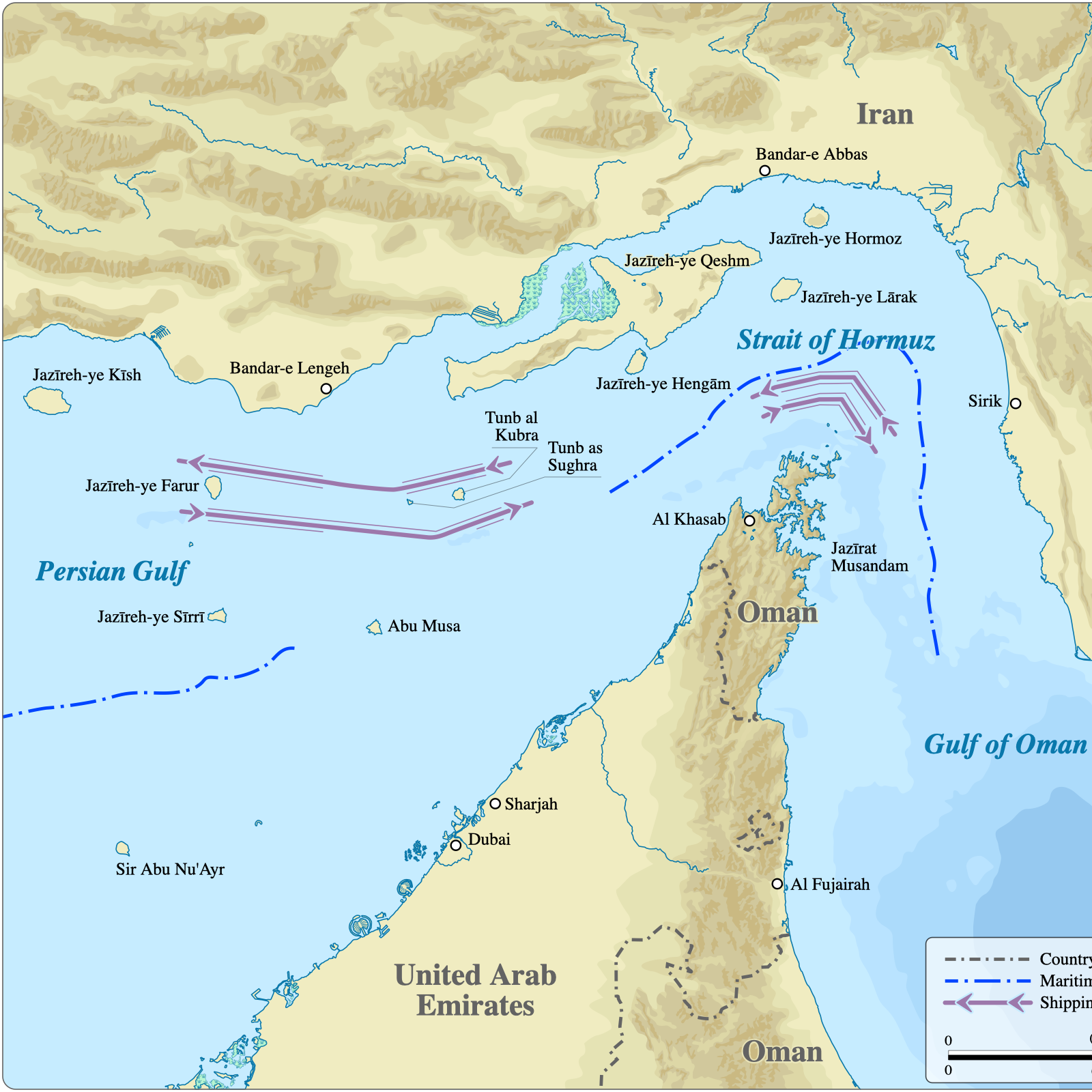
Aujourd’hui, une île située près de Bandar Abbas porte le nom d’Hormoz. Dans le passé, elle était connue sous le nom de « Nouvelle Hormoz ». Il est possible que le nom de l’île ait progressivement été associé au détroit voisin, donnant naissance à l’appellation actuelle.
L’origine exacte du mot « Hormoz » reste discutée. Certains chercheurs le rattachent à Ahura Mazda — également appelé Hormazd ou Ormuzd dans certaines traditions iraniennes anciennes. D’autres estiment qu’il pourrait provenir du nom d’un souverain sassanide appelé Hormazd. Quelle que soit son origine, le nom finit par désigner la voie maritime que le monde connaît aujourd’hui sous le nom de détroit d’Ormuz.
Les Portugais et le contrôle moderne du détroit · VI
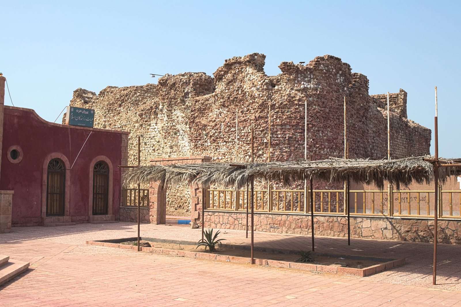
Au début du XVIᵉ siècle, les Portugais comprirent parfaitement l’importance stratégique du détroit. En 1515, Afonso de Albuquerque s’empara de l’île d’Ormuz et y fit construire une forteresse. Ils avaient compris qu’en contrôlant le détroit, ils pouvaient contrôler une grande partie du commerce maritime régional : les navires qui traversaient cette zone devaient passer sous leur surveillance et s’acquitter de taxes et de droits de passage. Pour la première fois dans l’histoire, le contrôle du détroit fut institutionnalisé comme instrument de puissance économique et géopolitique.
Cependant, cette domination ne dura pas. En 1622, sous le commandement de l’Imam Qoli Khan, général de Shah Abbas, les forces iraniennes — appuyées par la flotte de la Compagnie anglaise des Indes — reprirent l’île d’Ormuz et chassèrent les Portugais.
Une importance qui traverse les siècles · VII
Le départ des Portugais ne mit pas fin à la compétition autour du détroit. Les acteurs changèrent, mais la logique resta la même. Autrefois, le bronze, la soie, la porcelaine et les marchandises du monde antique transitaient par cette voie ; aujourd’hui, ce sont le pétrole, le gaz et les produits pétrochimiques. Autrefois des voiliers ; aujourd’hui des pétroliers, des porte-conteneurs et des navires de guerre. Mais l’essentiel n’a jamais changé : un passage étroit que les grandes routes commerciales sont contraintes de traverser. C’est pourquoi, chaque fois que le monde entre dans une nouvelle période de tensions, le nom du détroit d’Ormuz réapparaît.
Et aujourd’hui — Ormuz n’appartient pas à Zahaak · VIII
De ce passage que vingt empires se sont disputé, le régime étranger des Mollahs prétend aujourd’hui faire son arme. Une mafia exogène, qui prend la nation iranienne en otage, agite la menace de « fermer Ormuz », transforme un héritage de sept mille ans en outil de chantage, et brandit contre le monde un détroit qui ne lui appartient pas.
Car Ormuz n’est pas la propriété de la République islamique : il est le bien de la nation iranienne — comme il fut celui des Élamites, des Achéménides et de tous ceux qui vécurent sur ces rives bien avant que Zahaak ne s’empare de l’Iran. Les Portugais sont partis ; les empires se sont effacés ; le régime des Mollahs passera lui aussi. Le détroit, lui, restera — comme il a toujours été.
Et enfin · IX
Si l’on devait résumer toute cette histoire en une seule image, le détroit d’Ormuz apparaîtrait comme l’un des points les plus singuliers de l’histoire de la civilisation humaine. Depuis les transformations géologiques qui suivirent la dernière glaciation, en passant par les récits sumériens, la puissance élamite, les satrapies achéménides de Darius le Grand, les rivalités des empires antiques et les ambitions coloniales portugaises, ce détroit a toujours occupé une place centrale dans les échanges et les rapports de force.
L’histoire montre ainsi que l’importance du détroit d’Ormuz ne date pas de l’ère du pétrole : elle plonge ses racines dans plusieurs millénaires d’histoire humaine, de commerce, de navigation et de géopolitique. Pour cette raison, le détroit d’Ormuz demeure aujourd’hui encore l’un des espaces les plus stratégiques du monde. Et il demeurera pour toujours une partie de notre mère patrie : l’Iran.
تنگهٔ هرمز، همیشه پارهٔ ایرانزمین
« Ormuz — à jamais une part de l’Iran-zamin. »
— Sar-Ah, pour la Garde Javidan.
Iranica · Geopolitics · Civilisation
The Strait of Hormuz: a millennial importance, long predating oil
Seven thousand years of history in a passage just a few dozen kilometres wide.
If you believe that the importance of the Strait of Hormuz and of the maritime route off southern Iran rests on oil and energy alone, then a question arises: why, long before the Achaemenid Empire, did the great powers of Antiquity fight for control of this region — as the archaeological evidence attests?
If the strait mattered only because of oil, why did Alexander the Great send his fleet from India towards Hormuz and the shores of the Persian Gulf? Why did the Sasanian kings and their neighbours on the southern shore quarrel over it? Were these conflicts about something trivial?
Geological origins · I
The story of Hormuz reaches far back in time. Some ten to twelve thousand years ago, at the end of the last Ice Age, what we now call the Strait of Hormuz was not a stretch of sea at all. It was a vast plain covered with a saline crust, dotted with freshwater springs and frequented by the earliest human communities.
According to Dr Jeffrey Rose’s study “Persian Gulf Oasis,” the end of the Ice Age — with heavy rainfall and melting ice caps — caused sea levels to rise. The body of water we now call the Persian Gulf gradually took shape.
About seven thousand years ago, as the first communities settled between the Tigris and the Euphrates and across the southern Iranian plateau, these waters began to flow towards the ocean through this strategic passage. From then on, the route gained extraordinary importance.
Sumerian civilisation and the first sea routes · II
Sumerian and Akkadian texts repeatedly mention the lands around the Persian Gulf, describing a world connected to the civilisations of the Tigris and Euphrates by sea — with ships, goods and trade routes.
Archaeological discoveries and the translation of cuneiform tablets show that traders from the Indus Valley civilisation, from Elam and from other centres in the eastern Iranian plateau used the Sea of Oman, the Makran coast, the Persian Gulf and the Strait of Hormuz to carry their goods to the Sumerian cities.
One especially striking feature of five-thousand-year-old Sumerian texts is that they describe a distant land as the “City of the Gods,” home to benevolent deities. To reach that mythical land, one had to cross the Persian Gulf and the Strait of Hormuz. The evidence shows these sea routes were in use at least six thousand years ago — and every ship had to hug the shores of the Gulf.
Elam: the first power of the Gulf · III
Long before the Median and Achaemenid empires, southern Iran and the shores of the Persian Gulf belonged to a great Iranian civilisation that does not always receive the place it deserves in historical narratives: Elam. Its heart lay in present-day Khuzestan, and the Elamites ruled much of southern Iran for several millennia. For Iran as we know it was born of the fusion of two roots: the Elamites, the indigenous people of the south-west, and the Aryans who came down from the plateau — both flow in the veins of the Iranian nation.
We do not know what name they gave the Persian Gulf or the Strait of Hormuz, but archaeology clearly shows their close ties to the maritime world of the Gulf. This was no isolated coastal strip, but a region woven into a vast economic and cultural network.
Elamite texts reveal a genuine familiarity with the world of water. During Kidin-Hutran’s campaign against Babylon, the chronicles mention — alongside the land offensives — the use of the river routes linking the Karun to the Tigris and the Euphrates: river and sea were part of their world. The discovery of Elamite shrines and temples on the Gulf coast — notably at Liyan, today’s Bushehr — confirms the strategic importance of this maritime corridor. Under the Elamite kings, the territory stretched from the Gulf shores to regions near present-day Makran; Hormuz naturally fell within that sphere. This was already a thriving centre of civilisation long before it ever bore the name “Hormuz.”
The Achaemenids and a world-system · IV
The strait’s importance becomes even clearer in the Achaemenid era. Under Darius the Great, the sea routes were greatly developed. Darius undertook a navigable waterway linking Egypt to the Persian Empire — a forerunner of today’s Suez Canal.
For the first time, the sea routes of the Persian Gulf were integrated into an empire of global scale. In Darius’s inscriptions concerning this waterway, the Persian Gulf appears as a region belonging to the Persian realm. Darius was not speaking merely of a body of water, but of a strategic territory woven into his empire. From that time — some two thousand five hundred years ago — the Persian Gulf and the Strait of Hormuz entered the arena of great international politics. This is why Hormuz has never been an ordinary sea lane.
The origin of the name “Hormuz” · V
Today an island near Bandar Abbas bears the name Hormuz; in the past it was known as “New Hormuz.” The island’s name may gradually have attached itself to the neighbouring strait, giving rise to its present appellation.
The exact origin of the word “Hormuz” is still debated. Some scholars link it to Ahura Mazda — also called Hormazd or Ormuzd in certain ancient Iranian traditions. Others trace it to a Sasanian ruler named Hormazd. Whatever its origin, the name came to designate the sea passage the world knows today as the Strait of Hormuz.
The Portuguese and modern control of the strait · VI
In the early 16th century the Portuguese grasped the strait’s strategic value perfectly. In 1515, Afonso de Albuquerque seized Hormuz Island and built a fortress there. They understood that controlling the strait meant controlling much of the region’s maritime trade: ships passing through came under their watch and paid tolls and duties. For the first time in history, control of the strait was institutionalised as an instrument of economic and geopolitical power.
That dominion did not last. In 1622, under the command of Imam-Quli Khan, a general of Shah Abbas, Iranian forces — supported by the fleet of the English East India Company — retook Hormuz Island and drove the Portuguese out.
An importance that spans the centuries · VII
The Portuguese departure did not end the contest over the strait. The players changed, but the logic stayed the same. Once it was bronze, silk, porcelain and the goods of the ancient world that passed through; today it is oil, gas and petrochemicals. Once sailing ships; today tankers, container vessels and warships. Yet the essential never changed: a narrow passage the great trade routes are compelled to cross. That is why, each time the world enters a new period of tension, the name of Hormuz returns.
And today — Hormuz does not belong to Zahhak · VIII
Out of this passage that twenty empires fought over, the foreign regime of the Mullahs now claims to make a weapon. An alien mafia that holds the Iranian nation hostage brandishes the threat to “close Hormuz,” turns a seven-thousand-year heritage into a tool of blackmail, and holds against the world a strait that is not its own.
For Hormuz is not the property of the Islamic Republic: it belongs to the Iranian nation — as it belonged to the Elamites, the Achaemenids and all those who lived on these shores long before Zahhak seized Iran. The Portuguese left; the empires faded; the regime of the Mullahs will pass too. The strait will remain — as it always has.
And finally · IX
If all this history had to be captured in a single image, the Strait of Hormuz would stand as one of the most singular points in the history of human civilisation. From the geological upheavals that followed the last glaciation, through the Sumerian accounts, Elamite power, the Achaemenid satrapies of Darius the Great, the rivalries of ancient empires and Portuguese colonial ambition, this strait has always held a central place in trade and in the balance of power.
History thus shows that the importance of Hormuz did not begin with the age of oil: its roots run through several millennia of human history, of commerce, of navigation and of geopolitics. For this reason the Strait of Hormuz remains, to this day, one of the most strategic spaces on earth. And it will forever remain a part of our motherland: Iran.
تنگهٔ هرمز، همیشه پارهٔ ایرانزمین
“Hormuz — forever a part of Iran-zamin.”
— Sar-Ah, for the Garde Javidan.
ایرانیکا · ژئوپلیتیک · تمدن
تنگه هرمز؛ اهمیتی هزارانساله، بسیار پیش از نفت
هفت هزار سال تاریخ، در گذرگاهی به پهنای تنها چند ده کیلومتر.
اگر گمان میکنید که اهمیت تنگه هرمز و راه دریایی جنوب ایران تنها بر نفت و منابع انرژی استوار است، آنگاه پرسشی پیش میآید: چرا، بسیار پیش از شاهنشاهی هخامنشی، قدرتهای بزرگ جهان باستان بر سر تسلط بر این منطقه با یکدیگر میجنگیدند — چنانکه شواهد باستانشناسی گواهی میدهد؟
اگر اهمیت تنگه هرمز تنها به نفت بود، چرا اسکندر مقدونی ناوگانش را از هند بهسوی تنگه هرمز و کرانههای خلیج فارس فرستاد؟ چرا پادشاهان ساسانی و همسایگانشان در کرانه جنوبی خلیج بر سر این منطقه نزاع داشتند؟ آیا این درگیریها بر سر چیزی بیاهمیت بود؟
خاستگاه زمینشناختی · ۱
تاریخ تنگه هرمز به روزگاری بسیار کهن بازمیگردد. حدود ده تا دوازده هزار سال پیش، در پایان آخرین دوره یخبندان، جایی که امروز آن را تنگه هرمز مینامیم، اصلاً پهنهای دریایی نبود؛ دشتی پهناور بود پوشیده از سفرهای نمکی، آراسته به چشمههای آب شیرین و محل آمدوشد نخستین جوامع انسانی.
بنا بر پژوهش دکتر جفری رز در مطالعهی «واحه خلیج فارس» (Persian Gulf Oasis)، پایان عصر یخبندان — همراه با بارشهای سنگین و ذوب کلاهکهای یخی — موجب بالا آمدن سطح دریاها شد و آن توده آبی که امروز خلیج فارس مینامیم، اندکاندک شکل گرفت.
حدود هفت هزار سال پیش، هنگامی که نخستین جوامع میان دجله و فرات و در جنوب فلات ایران ساکن میشدند، این پهنه آبی از همین گذرگاه راهبردی بهسوی اقیانوس روان شد. از آن پس، این راه اهمیتی بیاندازه یافت.
تمدن سومر و نخستین راههای دریایی · ۲
متون سومری و اکدی بارها از سرزمینهای پیرامون خلیج فارس یاد میکنند و جهانی را وصف میکنند که از راه دریا به تمدنهای دجله و فرات پیوند خورده بود — با کشتیها، کالاها و راههای بازرگانی.
یافتههای باستانشناسی و ترجمه لوحهای میخی نشان میدهد که بازرگانانِ تمدن دره سند، عیلام و دیگر کانونهای تمدنی شرق فلات ایران، از دریای عمان، کرانه مکران، خلیج فارس و تنگه هرمز برای رساندن کالاهای خود به شهرهای سومری بهره میبردند.
نکتهای شگفت در متون پنجهزارساله سومری آن است که سرزمینی دوردست را «شهر خدایان» میخوانند؛ خانه ایزدانی نیکخواه. برای رسیدن به آن سرزمین اسطورهای، میبایست از خلیج فارس و تنگه هرمز گذشت. شواهد نشان میدهد کاربرد این راههای دریایی دستکم به شش هزار سال پیش میرسد — و هر کشتی ناگزیر میبایست در امتداد کرانههای خلیج پیش میرفت.
عیلام: نخستین قدرت خلیج · ۳
بسیار پیش از برآمدن شاهنشاهیهای ماد و هخامنشی، جنوب ایران و کرانههای خلیج فارس از آنِ تمدنی بزرگ و ایرانی بود که همیشه جایگاه شایستهاش را در روایتهای تاریخی نمییابد: تمدن عیلام. کانون آن در خوزستانِ امروز بود، و عیلامیان هزارهها بر بخش بزرگی از جنوب ایران فرمان راندند. زیرا ایرانِ امروز از آمیزشِ دو ریشه زاده شده است: عیلامیان، مردمِ بومیِ جنوبغرب، و آریاییانی که از فلات فرود آمدند — و هر دو در رگهای ملت ایران جاریاند.
نمیدانیم چه نامی بر خلیج فارس یا تنگه هرمز مینهادند، اما پژوهشهای باستانشناسی پیوند تنگاتنگ آنان را با جهان دریایی خلیج بهروشنی نشان میدهد. این تنها یک نوار ساحلی منزوی نبود، بلکه منطقهای بود تنیده در شبکهای گسترده از اقتصاد و فرهنگ.
متون عیلامی از آشنایی راستین آنان با جهان آب حکایت دارد. در لشکرکشی کیدینهوتران به بابِل، تواریخ — در کنار تهاجمهای زمینی — از کاربرد آبراههای پیونددهنده کارون به دجله و فرات یاد میکنند: رود و دریا بخشی از جهان آنان بود. کشف نیایشگاهها و معابد عیلامی در کرانههای خلیج — بهویژه در لیان، بوشهرِ امروز — اهمیت راهبردی این کریدور دریایی را تأیید میکند. زیر فرمان شاهان عیلام، قلمرو از کرانههای خلیج تا نواحی نزدیک مکرانِ کنونی کشیده میشد؛ و تنگه هرمز بهطبیعت در همین حوزه نفوذ جای داشت. این منطقه پیش از آنکه حتی نام «هرمز» بر خود گیرد، کانونی پویا از تمدن بود.
هخامنشیان و پیوستن به یک نظام جهانی · ۴
اهمیت تنگه هرمز در روزگار هخامنشی آشکارتر میشود. در دوران داریوش بزرگ، راههای دریایی بهشکلی چشمگیر گسترش یافت. داریوش آبراهی ساخت که مصر را به شاهنشاهی پارس میپیوست — پیشدرآمدِ کانال سوئزِ امروز.
برای نخستین بار، راههای دریایی خلیج فارس در نظامی شاهنشاهی با گسترهای جهانی ادغام شد. در سنگنبشتههای داریوش درباره این آبراه، خلیج فارس همچون منطقهای متعلق به قلمرو پارس یاد میشود. داریوش نه از یک پهنه آب، بلکه از سرزمینی راهبردی و درهمتنیده با شاهنشاهیاش سخن میگفت. از آن روزگار — حدود دو هزار و پانصد سال پیش — خلیج فارس و تنگه هرمز به میدان سیاست بزرگ بینالمللی پای نهادند. از همین روست که هرمز هرگز یک آبراه معمولی نبوده است.
خاستگاه نام «هرمز» · ۵
امروز جزیرهای نزدیک بندرعباس نام هرمز دارد؛ در گذشته آن را «هرمز نو» میخواندند. شاید نام جزیره اندکاندک به تنگه همسایه پیوست و نام کنونی از آن پدید آمد.
خاستگاه دقیق واژه «هرمز» هنوز محل بحث است. برخی پژوهشگران آن را به اهورامزدا — که در برخی سنتهای کهن ایرانی هورمزد یا اورمزد نیز خوانده میشود — پیوند میدهند. دیگران آن را برگرفته از نام پادشاهی ساسانی به نام هرمزد میدانند. خاستگاه هرچه باشد، این نام سرانجام همان آبراهی را نامید که جهان امروز آن را تنگه هرمز میشناسد.
پرتغالیها و تسلط نوین بر تنگه · ۶
در آغاز سده شانزدهم، پرتغالیها ارزش راهبردی تنگه را بهخوبی دریافتند. در سال ۱۵۱۵، آفونسو دِ آلبوکرکی جزیره هرمز را گرفت و در آن دژی برافراشت. آنان دریافته بودند که با تسلط بر تنگه میتوانند بخش بزرگی از بازرگانی دریایی منطقه را در دست گیرند: کشتیهایی که از این پهنه میگذشتند زیر نظارت آنان قرار میگرفتند و باج و حق عبور میپرداختند. برای نخستین بار در تاریخ، تسلط بر تنگه همچون ابزار قدرت اقتصادی و ژئوپلیتیک نهادینه شد.
اما این چیرگی پایدار نماند. در سال ۱۶۲۲، به فرماندهی امامقلیخان، سردار شاهعباس، نیروهای ایرانی — با پشتیبانی ناوگان کمپانی هند شرقی انگلیس — جزیره هرمز را بازپس گرفتند و پرتغالیها را بیرون راندند.
اهمیتی که از سدهها میگذرد · ۷
رفتن پرتغالیها به رقابت بر سر تنگه پایان نداد. بازیگران دگرگون شدند، اما منطق همان ماند. روزگاری مفرغ و ابریشم و چینی و کالاهای جهان باستان از این راه میگذشت؛ امروز نفت و گاز و فرآوردههای پتروشیمی. روزگاری بادبانها؛ امروز نفتکشها و کشتیهای باری و ناوهای جنگی. اما گوهر ماجرا هرگز دگرگون نشد: گذرگاهی تنگ که راههای بزرگ بازرگانی ناگزیر از گذشتن از آناند. از همین روست که هر بار جهان به دورهای تازه از تنش پای مینهد، نام تنگه هرمز بازمیگردد.
و امروز — هرمز از آنِ ضحاک نیست · ۸
از این گذرگاهی که بیست شاهنشاهی بر سرش جنگیدند، رژیمِ بیگانهٔ ملاها امروز میخواهد سلاحی بسازد. مافیایی بیگانه که ملت ایران را به گروگان گرفته است، تهدیدِ «بستن هرمز» را بالا میگیرد، میراثی هفتهزارساله را به ابزار باجخواهی بدل میکند، و تنگهای را که از آنِ او نیست در برابر جهان میجنباند.
زیرا هرمز ملکِ جمهوری اسلامی نیست: از آنِ ملت ایران است — چنانکه از آنِ عیلامیان و هخامنشیان بود و از آنِ همه کسانی که بر این کرانهها زیستند، بسیار پیش از آنکه ضحاک بر ایران چنگ اندازد. پرتغالیها رفتند؛ شاهنشاهیها محو شدند؛ رژیم ملاها نیز خواهد گذشت. اما تنگه میمانَد — چنانکه همیشه مانده است.
و سرانجام · ۹
اگر بنا بود همه این تاریخ را در یک تصویر خلاصه کنیم، تنگه هرمز یکی از یگانهترین نقاط تاریخ تمدن بشری جلوه میکرد. از دگرگونیهای زمینشناختی پس از واپسین یخبندان، تا روایتهای سومری، قدرت عیلام، ساتراپهای هخامنشیِ داریوش بزرگ، رقابت شاهنشاهیهای باستان و جاهطلبی استعماری پرتغال، این تنگه همواره جایی مرکزی در داد و ستد و در موازنه قدرت داشته است.
تاریخ چنین نشان میدهد که اهمیت تنگه هرمز با عصر نفت آغاز نشده است: ریشههای آن در هزارهها تاریخ انسانی، بازرگانی، دریانوردی و ژئوپلیتیک فرورفته است. از همین رو، تنگه هرمز تا به امروز یکی از راهبردیترین پهنههای جهان مانده است. و برای همیشه پارهای از میهن ما خواهد ماند: ایران.
تنگهٔ هرمز، همیشه پارهٔ ایرانزمین
«هرمز — همیشه پارهای از ایرانزمین.»
— سارا، برای گارد جاویدان.
Sources / منابع : Jeffrey Rose, « New Light on Human Prehistory in the Arabo-Persian Gulf Oasis » (Current Anthropology) · Encyclopædia Iranica (« Hormuz », « Elam », « Persian Gulf ») · D. T. Potts, The Archaeology of Elam · UNESCO (Tchoga Zanbil, n° 113) · inscriptions de Darius (canal du Nil à la mer Rouge). Médias : NASA/MODIS (domaine public) ; Wikimedia Commons (CC BY-SA 4.0).